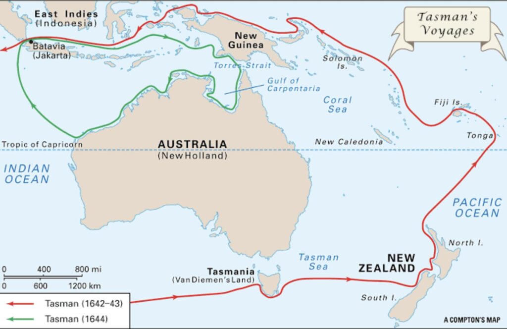
The Tasman expedition left Batavia (Netherlands East Indies, now Jakarta, Indonesia) on 14th August 1642 with two vessels, the Heemskerk with a 60-man crew and the Zeehaan with 50 men on board. They first called at Mauritius, where they stayed for a month-long repair to both ships.
Intending to sail eastward at the southern latitude of 52 or 54 degrees, it became evident early on that weather would not permit this. It was decided to sail along the 44th and 40th parallels and as the two ships reached the longitude of the islands of St Peter and St Francis on the South Australian coast, then travelled further south, sighting Tasmania on 24th November 1642. Tasman named the island after the governor of The Dutch East Indies, Antonio van Diemen. The first two mountains they sighted on the island were named Mount Zeehan and Mount Heemskerk, after their ships. Variable weather made exploration of the eastern coast of Van Diemen’s Land difficult. Seeking shelter in a large bay, Tasman put into a cove to shelter from a storm. He called the location Storm Bay. A later explorer (Furneaux) misread Tasman’s notes and called this bay Adventure Bay and a larger bay nearby was erroneously marked on Furneaux’s charts as Storm Bay.
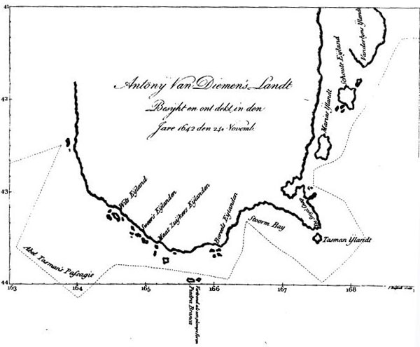
On 1st December, the storm having abated, the ships were able to move on before coming to anchor at Green Island. They put ashore for supplies at what is now known as Blackman Bay (north of Dunalley). Two days later, the carpenter, Peter Jacobsen, volunteered to swim ashore with a pole on which was the Prince’s flag, which he planted on the shore of the bay. Thus, Tasman took possession of the island for the Dutch. Not finding enough good water, Tasman moved on and continued his search, traversing the east coast of Tasmania. Source: Our Tasmania
Tasman Monuments
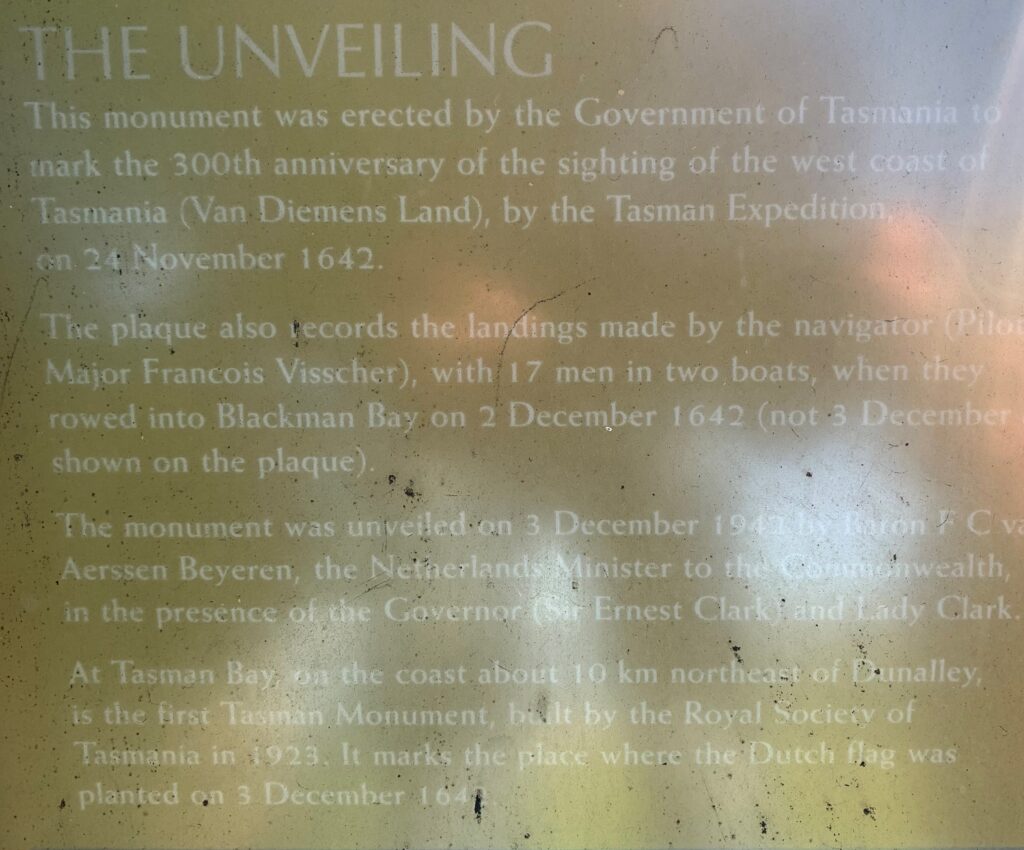
There are two monuments commemorating this event in the broader Dunalley area, east of Hobart. The monument in the township of Dunalley dates from 1942, while the older one, dating back to 1923, stands on private land within the Bangor property on Tasman Bay. Access to this site requires special permission and is only possible on foot, with the return walk taking approximately five to six hours to complete.
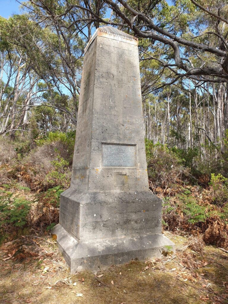
Tasman Monument Bangor 1923
This what the Sydney Morning Herald wrote about the unveiling of this monument. The unveiling of a memorial erected by the Royal Society of Tasmania with the support of citizens, on the spot where Abel Janszoon Tasman planted the Dutch flag in Tasmania in 1642, was performed on Monday. A party of 27 persons visited the site of the monument at Prince of Wales Bay, on the east coast of Forestier Peninsula, and the Memorial was unveiled by the Administrator, Sir Herbert Nicholls. The monument is of solid concrete, 12ft 6in high and 4ft 6in at the base. It stands in a conspicuous place on the edge of the bay close to the high-water mark.
The Sydney Morning Herald, 5th December 1923.
Source: Monument Australia
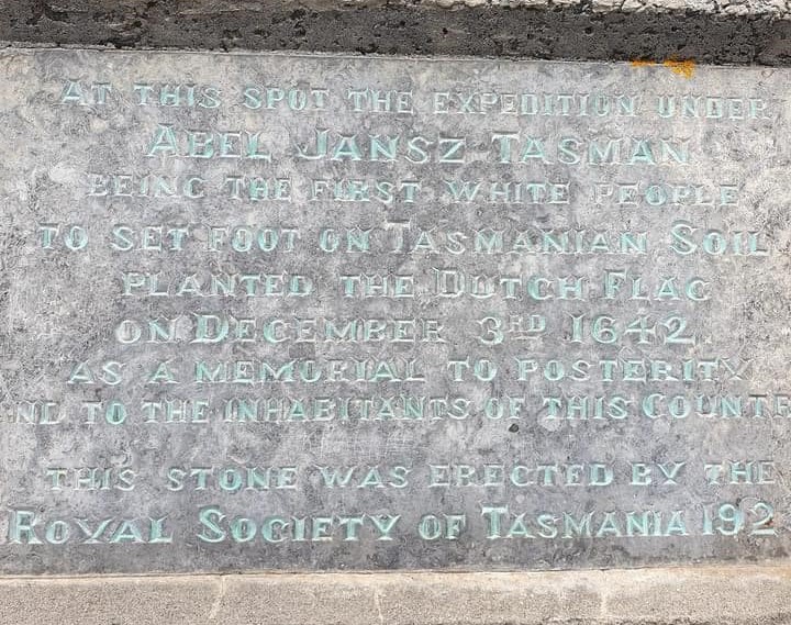
Abel Jansz Tasman
Being the first white people
to set foot on Tasmanian soil
Planted the Dutch Flag
on December 3 , 1642.
As a memorial to posterity
and to the inhabitants of this country
This stone was erected by
the Royal Society of Tasmania 1923.
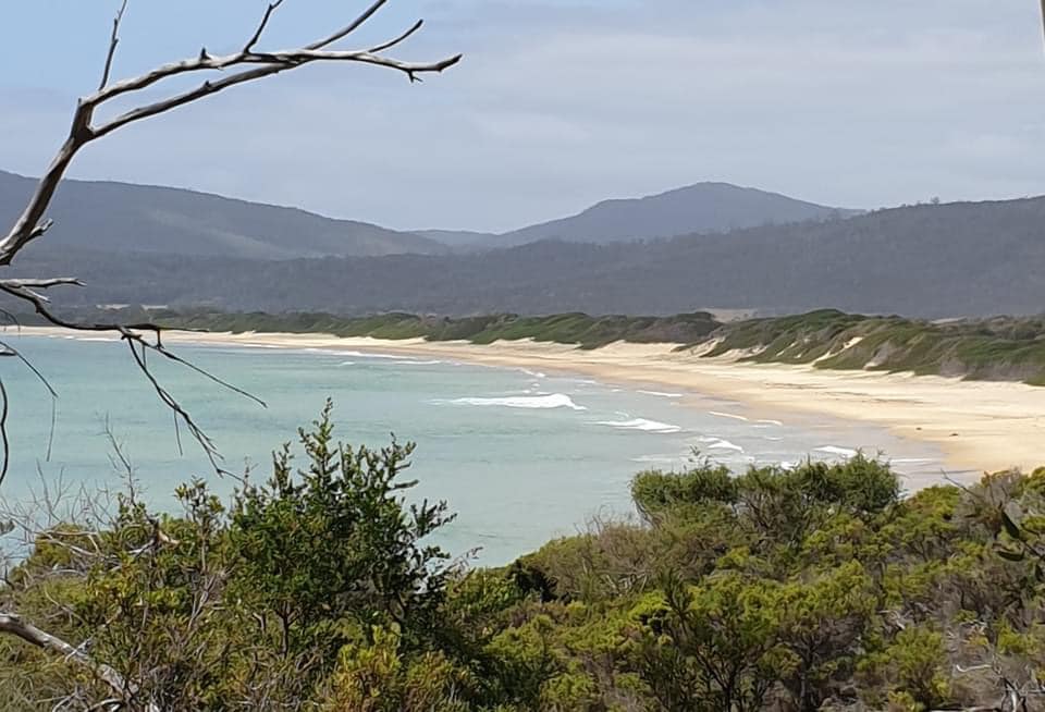
The pictures below are taken at the precise isolated location where Abel Tasman and his crew of sailors and scientists planted the Dutch flag. Klaas Laning recently captured rare photos of the memorial at this isolated landing spot, which is largely unknown to tourists. It’s worth noting that this memorial sits on private property, within the Bangor Estate, and access requires permission. Klaas and his companion obtained permission to camp on the estate and embarked on a 5-6 hour hike from the campsite to reach this historic site. Information received with thanks to Keith Paulusse.
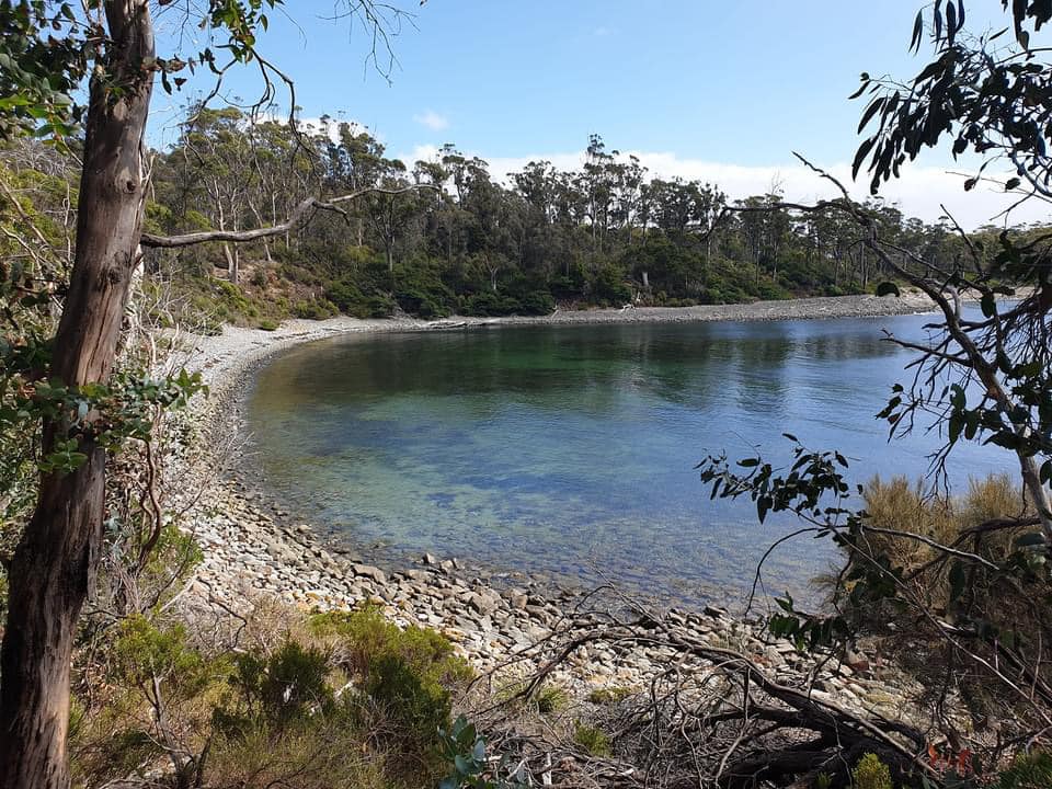
How to get there (Permission required) by way of Tasman Monument Track
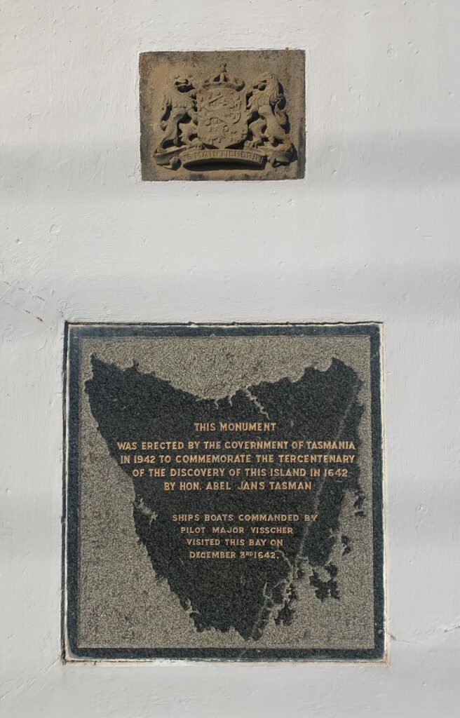
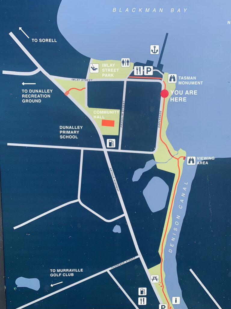
Tasman Monument Dunalley, 1942
During WWII, Australia became home to a large Dutch community in exile, including officials, military personnel, merchant navy crews, and civilians who had fled the Netherlands East Indies after the Japanese invasion in early 1942. The arrival of the first Netherlands Ambassador to Australia that same year formalised diplomatic ties, giving the Dutch presence even greater visibility.
Against this backdrop, the 300th anniversary of Abel Tasman’s landing in Tasmania (1642) was commemorated in 1942 with official events attended by both Australian and Dutch dignitaries. The celebrations served not only as a cultural link between the two nations but also as a morale boost during a difficult wartime period. Jack Ford’s account notes that the Dutch community, already active in public life through concerts, fundraising, and civic participation, viewed the Tasman anniversary as an opportunity to demonstrate their enduring connection to Australia and its history.
In Sydney, the event included speeches highlighting Tasman’s role in European exploration of the region and the shared maritime heritage of the Netherlands and Australia. Dutch military representatives, embassy staff, and community leaders joined Australian officials in ceremonies, with some functions doubling as war-bond fundraising occasions. These public gatherings reinforced the image of the Netherlands as an active and loyal ally in the South West Pacific theatre.
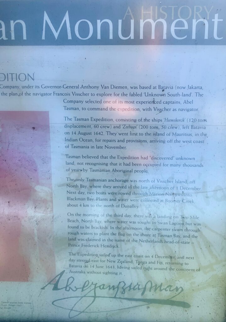
Information at the site in Dunalley
The following pictures were made by John Nobel in August 2025.
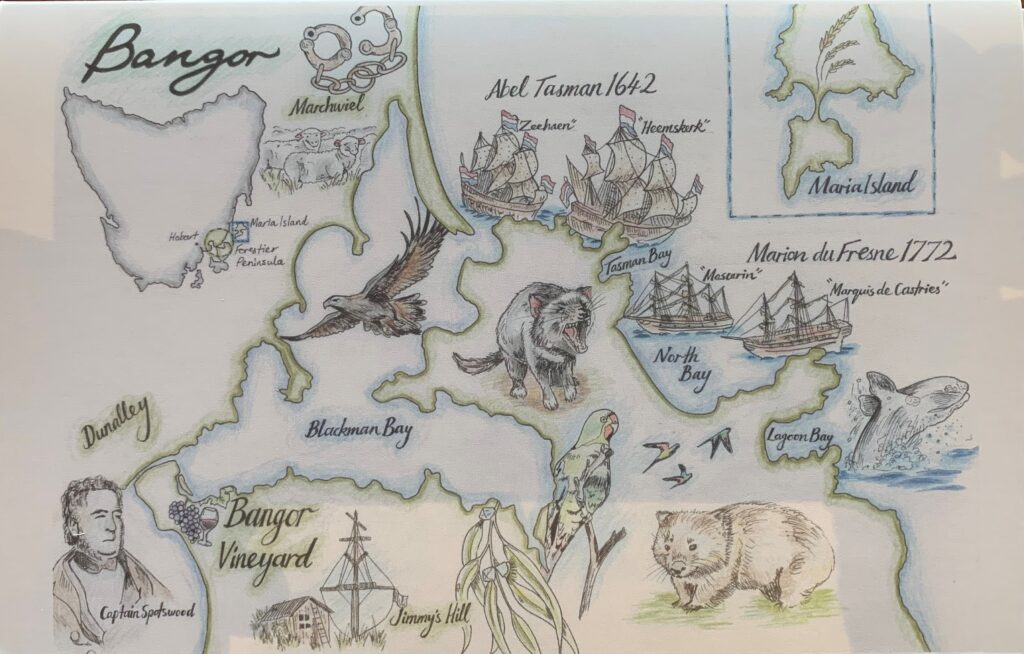
See also: First Dutch contacts in Australia – Tasmania 1642 to 1772