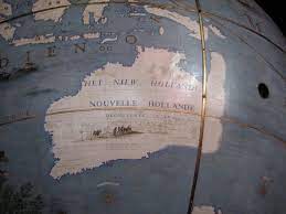
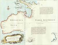
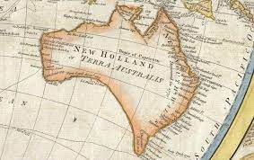
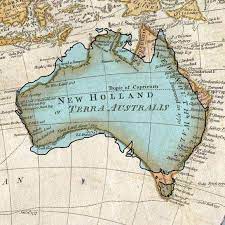
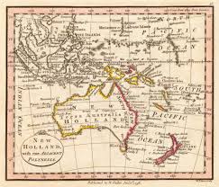
The name New Holland (Hollandia Novae) appeared on maps depicting the continent of Australia after the Dutch seafarer Abel Tasman charted the west coast of the continent in 1644. According to linguist Dr. Jan Tent (see paper below), the name was probably given to the continent by one of the cartographers of those early maps.
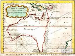
Tasman was the first European to explore the western and northern coasts of Australia. The name came from the Dutch province of Holland and was used to refer to the southern land mass that Europeans had speculated about for centuries. The name New Holland was used on most European maps until the early 19th century. However, the Dutch did not claim any territory in Australia as their own, and did not settle there.
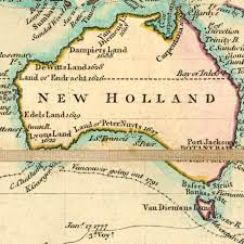
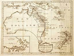
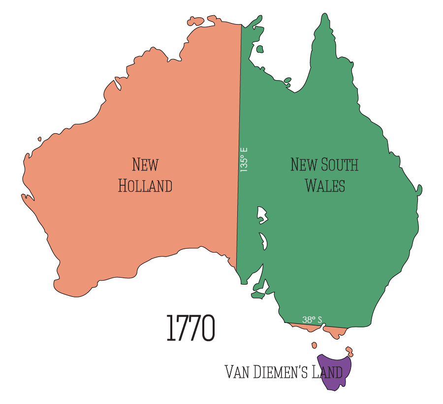
When, in 1770, James Cook claimed the east coast of New Holland for the British Crown, he named it New South Wales. As the Dutch had never explored the East Coast it was easy for Britain to claim this part of the continent.
James Cook’s Declaration
| Having satisfied myself of the great Probability of a passage, thro’ which I intend going with the Ship, and therefore may land no more upon this Eastern coast of New Holland, and on the Western side I can make no new discovery, the honour of which belongs to the Dutch Navigators, but the Eastern Coast from the latitude of 38 degrees South down to this place, I am confident, was never seen or Visited by any European before us; and notwithstanding I had in the Name of his Majesty taken possession of several places upon this Coast, I now once More hoisted English Colours, and in the Name of His Majesty King George the Third took possession of the whole Eastern coast from the above latitude down to this place by the Name of New Wales, together with all the Bays, Harbours, Rivers, and Islands, situated upon the said Coast; after which we fired 3 Volleys of small Arms, which were answer’d by the like number from the Ship. Captain James Cook – 22 Aug 1770 |
At this stage the western sector of the continent, from Longitude 135o E, westward and the sector southward of Latitude 38o S, remained “New Holland“, noting that Abel Tasman’ had ‘discovered’ the southern Tasmanian land mass during his voyage of discovery of 1642. Interestingly this also included the southern part of Victoria.
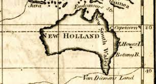
With the Netherlands being occupied by the French, the collapse of the VOC and the weakening position of the Dutch in the East Indies, the British felt safe to make bolder claims. The argument was that it was not the Dutch Government but the VOC who had given the continent the Dutch names. In contrast NSW was claimed on behalf of the British Government and they therefore had more legitimacy. By the early 19th century the name NSW was applied to the full eastern half of New Holland.
The naming of Australia
The British settlement of Sydney in 1788 prompted Britain to formally claim the east coast as New South Wales, leading to a search for a new collective name. Terra Australis (Southland) was another name that was used on earlier maps.
The name Australia was suggested by the English explorer Matthew Flinders, who was the first to circumnavigate the continent in 1803. He used the name Australia to describe the continent on a hand-drawn map in 1804, but his book and map were not published until 1814. He preferred the name Australia over Terra Australis, which was another common name for the southern land. The name Australia comes from the Latin word australis, meaning southern.
The name Australia gradually replaced New Holland in official and popular usage and had totally disappeared by the 1850s. The Governor of New South Wales, Lachlan Macquarie, endorsed the name Australia in a dispatch to London in 1817. The British Admiralty started to use the name officially in 1824.
The name Australia was first used in British legislation in 1828 to apply to the colonies of New South Wales and Van Diemen’s Land. The name Commonwealth of Australia for the nation of six federated colonies was formalised in 1900.
Only the State of Tasmania (Van Diemen’s Land) kept its Dutch name.